Complete coverage of the public owners
in the territory you actually serve.
A single territory can cover 40 school districts, 80 municipalities, and dozens of park districts, counties, and authorities — each with its own meeting cadence, document repository, and capital cycle. Sympl · Signal monitors all of them for you.
The scale problem
Most BD teams cover 3–5 entities well. The other 75 are guesswork.
Public construction intelligence is a coverage problem. The information is public. The problem is that it's distributed across hundreds of entities, each publishing documents on its own schedule, in its own format, at its own URL.
A BD manager who manually covers a 40-district territory reads 3–5 board packets well and guesses at the rest. That means roughly 8% of visible opportunities are actually seen.
40+
School districts in a typical metro territory
80+
Municipalities in a typical multi-county territory
12–24
Months of forward visibility in a public CIP
Same day
Time to stand up monitoring for your territory
What we monitor
Every public entity type that drives construction in your territory.
We discover and monitor all of these automatically when you define your coverage area.
K-12 school districts
The single largest source of public construction in most territories. Bond cycles, CIPs, and facilities master plans provide 12–24 months of forward visibility.
Municipalities
City halls, public works, fire stations, police facilities, and parks departments. Often multiple departments with separate CIPs.
Parks & Recreation departments
Grant-driven, master-plan-driven, and distributed. A single parks master plan refresh can represent a multi-year backlog.
Counties
Courthouses, administration buildings, correctional facilities, and county road programs. Often large single-project opportunities.
Community colleges & universities
Higher ed has its own bond and capital planning cycles — often parallel to but separate from K-12.
Special districts
Library, fire, water, housing, and hospital districts. Each with its own governing board and capital program.
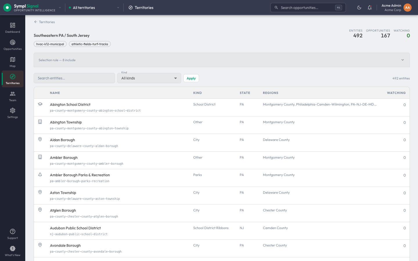
A single territory here monitors 492 public entities — every district, township, borough, parks department, and authority that drives construction in the area.
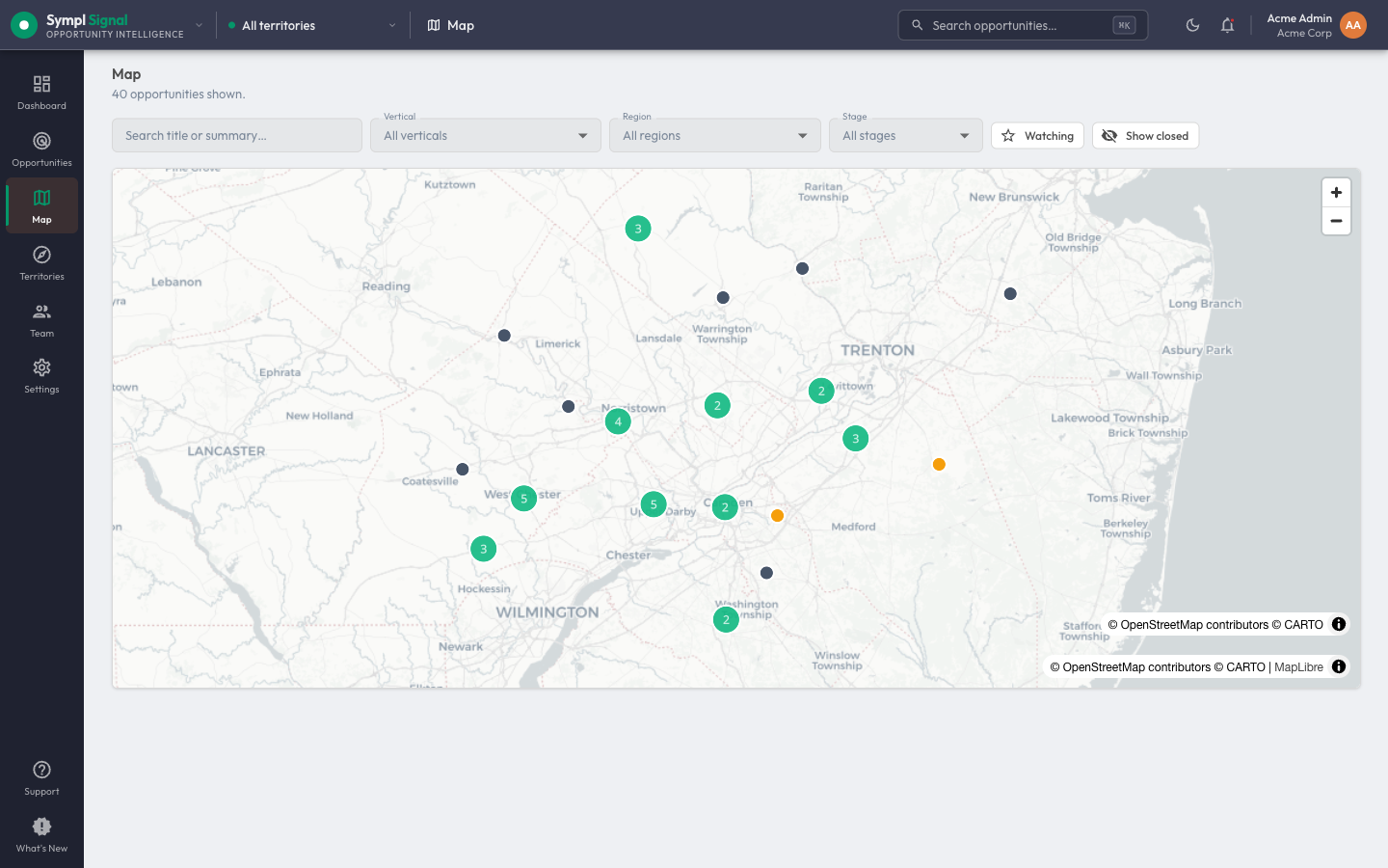
See the whole territory at a glance — every detected opportunity mapped and staged across the geography you cover.
Getting live
You pick the territory. We handle everything else.
No spreadsheets, no FOIA requests, no bookmark folders. Tell us where you sell — we handle entity discovery and source monitoring, and your dashboard goes live the same business day.
You define coverage
Tell us the regions, counties, or specific districts you want to cover. You can define territory by geography, owner type, or specific entity lists.
We discover every entity
We map every public entity within your defined territory — school districts, park districts, municipalities, counties, authorities, and special districts — and their meeting and document repositories.
Sources go live same day
Your territory's public entities are monitored from that point forward. New meetings, published documents, and CIP updates flow into your dashboard automatically.
Cover every public entity in your territory.
Tell us the regions you serve. We stand up comprehensive coverage the same business day.